Oh Canada!
The lovely Karin and I just got back from a week’s vacation road tripping deep into the Canadian Rockies. It was a great trip and fun to see just how large the scale is for the mountains there. Here in Montana the hills are pretty darn big but they pale in comparison and the Canadian Rockies are so large that it’s hard to relate to the scale of things.
From Bozeman we headed north through Missoula and then north to the west side of Glacier Park. We toured around a bit before heading North into Canada. We headed up to Lake Louise and spent two days there hiking around and taking photos of the Glaciers. From there we continued north to the Columbia Ice Field. The size of this is hard to grasp and even standing there on it was impossible for me to really relate to.
We then turned south toward home and took our time getting home and taking in the scenery. One thing really fun about traveling with Karin is that, being a geologist, she can explain how all these mountains, glaciers and valleys formed and it gives even more respect for time and size. We are very small and short lived for sure.
I’ve included some photos of the trip to give you just the slightest feel of what it looks like.
Thanks for looking. Back to bikes for the next installment.
Dave
-
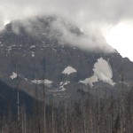
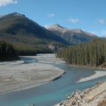
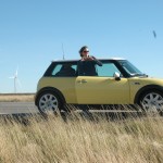
- first photo taken
-
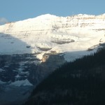
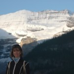
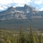
- view from hotel.
-
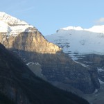
- view from hotel
-
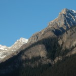
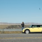
- roadside view
-
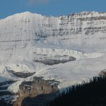
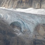
- Note for scale – the vertical ice wall here is 80 meters tall.
-
- view from hotel
-
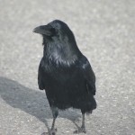
- every roadside pullout had a pair of these guys begging for cookies.
-
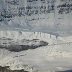
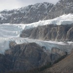
- ice cave – must be well over 100′ feet tall
-
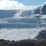
- overview
-
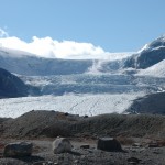
- Glacier spilling off Columbia Ice Field – for scale note ‘ice bus’ driving up glacier in the lower left.
-
- Iced coffee and sandwiches.
-
- view from road
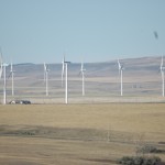
-
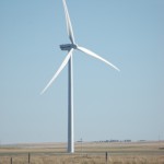
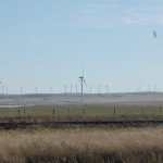
- for scale note telephone pole near base of windmill
-
- wishing we had more wind power in the states.
Share this Article:
3 responses to “Oh Canada!”
Leave a Reply
You must be logged in to post a comment.


Hey Dave I’m glad you guys had a good time and are home safe. I see several similar photos that you’ve got listed as being taken from the hotel. As you stated the scale is tough to appreciate what would you say the distance actually was from your vantage point? The wind turbine is also really striking especially considering the utility pole that’s in the shot. As always thanks for sharing.
Hey Parris,
I have a good long lens on the camera so it’s hard to see the distance. The hotel was a bit less than 3 1/2 miles from the glacier so you can see just how big that stuff is. We hiked up close to the base of that glacier in the cold, cold rain and you could just really start to grasp the scale.
Pretty cool stuff.
dave
Cool photos, Dave and Karin. You are right in that the Canadian Rockies are on a different scale. The first photo taken was from my “NeckaTheWoods”
Back in High School, some friends and I ATTEMPTED to climb the highest peak in the Canadian Rockies, Mount Robson, which is north of Jasper. The route we chose was the Cain face which is long (2000 ft?) and steep (45 deg ice)
We go snowed off the mountain (in July) We were LUCKY to find our route back down, and not get buried in an avalanche doing so.
In retrospect, I should have known better that to try to attempt Robson, because there was not one photo of the summit in all the photos at visitor center.
I’m glad you had a great trip, and thank-you for shared the photos with us. I bet it is fun to travel with a Geologist! (and a cute one at that!)
John